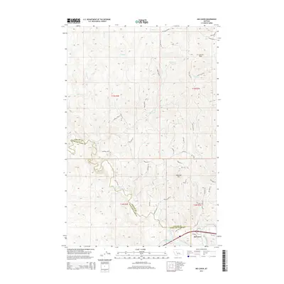
2014 Map of Mid Canon
USGS Topo · Published 2014About this map
The confluence of the Dearborn River and the Missouri River anchors this 2014 survey of the canyons along the boundary of Cascade and Lewis and Clark Counties. The landscape is defined by its dramatic elevation changes, rising from the riverbanks to prominent summits like Sawmill Peak and Sugarloaf Mtn. The settlement of Mid Canon sits near the southern edge of the map, connected to the surrounding high country by a network of winding roads such as Old US-91 and Eagle Rock Rd. Numerous drainage systems, including Trout Cr, Sullivan Cr, and Sawmill Cr, have carved deep paths through the terrain, illustrating the complex hydrological network that feeds into the Missouri. Residential and access routes like Wiegand Park Rd and Sunquist Park Ln suggest a modern layer of land use and development nestled within the traditional ranching and mountain geography of central Montana.
Find a feature on this map
48 named features on this map. Tap any name to fly to it.
Don’t see what you’re looking for? This feature index may not catch every label — zoom into the map to look around manually.
Map Details
Editions of this 2014 Mid Canon Map
This is the sole edition of this map. No revisions or reprints were ever made.
Other maps of this area

1886 · Great Falls
USGS Topo · 1:250,000

1943 · Hogan
USGS Topo · 1:125,000

1954 · Great Falls
USGS Topo · 1:250,000

1955 · Choteau
USGS Topo · 1:250,000

1957 · Choteau
USGS Topo · 1:250,000

1957 · Great Falls
USGS Topo · 1:250,000

1958 · Choteau
USGS Topo · 1:250,000

1960 · Simms
USGS Topo · 1:62,500

1961 · Craig
USGS Topo · 1:24,000

1961 · Hardy
USGS Topo · 1:24,000