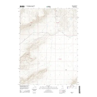
2014 Map of Midas
USGS Topo · Published 2014About this map
Midas sits at the northeastern edge of this Elko County quadrangle, a settlement defined by the high-elevation terrain of the Nevada desert. The landscape is dominated by significant geographic rises including Jake Creek Mtn and the Owyhee Bluffs, which overlook a complex network of seasonal drainage systems. Water sources such as Midas Cr, Summit Cr, and Clover Cr carve through the basins, leading toward the broad expanse of Squaw Valley in the south. For those researching local history, the Midas Cemetery is clearly marked just north of the townsite along NV 18. This survey details the remote infrastructure of the region, specifically CR-724, which serves as a primary artery through the high country past Horseshoe Mtn.
Find a feature on this map
19 named features on this map. Tap any name to fly to it.
Don’t see what you’re looking for? This feature index may not catch every label — zoom into the map to look around manually.
Map Details
Editions of this 2014 Midas Map
This is the sole edition of this map. No revisions or reprints were ever made.
Other maps of this area

1955 · McDermitt
USGS Topo · 1:250,000

1959 · McDermitt
USGS Topo · 1:250,000

1965 · Sixmile Hill
USGS Topo · 1:24,000
1965 · Jake Creek Mtn
USGS Topo · 1:24,000

1965 · Squaw Valley Ranch
USGS Topo · 1:24,000
1965 · Midas SW
USGS Topo · 1:24,000
1965 · Midas
USGS Topo · 1:24,000

1965 · Rock Creek Ranch
USGS Topo · 1:24,000

1973 · Snowstorm Mtn
USGS Topo · 1:24,000

1977 · Scraper Springs
USGS Topo · 1:24,000