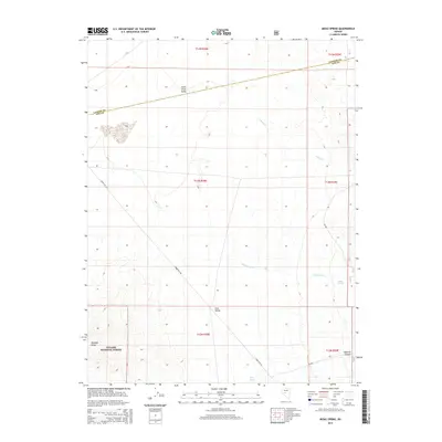
2014 Map of Midas Spring
USGS Topo · Published 2014About this map
Smith Creek Valley and Ione Valley dominate this high-desert basin-and-range landscape, where the Lander Co and Nye Co line cuts diagonally across the northern sagebrush flats. To the southwest, the foothills of the Paradise Range rise sharply into the Toiyabe National Forest, providing a stark topographical contrast to the broad alluvial valleys. Water sources are scarce in this arid environment, making features like Midas Spring and the intermittent drainage of Lebeau Cr critical landmarks for navigation and land use. The presence of Snake Bite Rd and forest route NF-060 suggests the continued importance of back-country access for ranching or resource management within the Great Basin. This survey records the sparsely populated interior of Nevada, highlighting the intersection of federal forest lands and remote county boundaries.
Find a feature on this map
12 named features on this map. Tap any name to fly to it.
Don’t see what you’re looking for? This feature index may not catch every label — zoom into the map to look around manually.
Map Details
Editions of this 2014 Midas Spring Map
This is the sole edition of this map. No revisions or reprints were ever made.
Other maps of this area

1907 · Tonopah
USGS Topo · 1:250,000

1908 · Tonopah
USGS Topo · 1:250,000

1948 · Paradise Peak
USGS Topo · 1:62,500

1948 · Ione
USGS Topo · 1:62,500

1950 · Paradise Peak
USGS Topo · 1:62,500

1950 · Ione
USGS Topo · 1:62,500

1955 · Millett
USGS Topo · 1:250,000

1956 · South Shoshone Peak
USGS Topo · 1:62,500

1956 · Tonopah
USGS Topo · 1:250,000

1959 · Tonopah
USGS Topo · 1:250,000