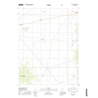
2018 Map of Midas Spring
USGS Topo · Published 2018About this map
Midas Spring sits at the base of the Paradise Range in this high-desert landscape within the Toyabe National Forest. The map documents a sparsely populated region of central Nevada where the Smith Creek Valley transitions into the Ione Valley. This 2018 survey reveals a network of seasonal drainages, including Sunnyside Cr and Lebeau Cr, which define the hydrological patterns of the basin. The inclusion of the Natl Forest Develop Road 060 Rd and the Lander Co Nye Co boundary line offers critical context for understanding the jurisdictional and transport infrastructure of this interior basin and range territory.
Find a feature on this map
19 named features on this map. Tap any name to fly to it.
Don’t see what you’re looking for? This feature index may not catch every label — zoom into the map to look around manually.
Map Details
Editions of this 2018 Midas Spring Map
This is the sole edition of this map. No revisions or reprints were ever made.
Other maps of this area

1907 · Tonopah
USGS Topo · 1:250,000

1908 · Tonopah
USGS Topo · 1:250,000

1948 · Paradise Peak
USGS Topo · 1:62,500

1948 · Ione
USGS Topo · 1:62,500

1950 · Paradise Peak
USGS Topo · 1:62,500

1950 · Ione
USGS Topo · 1:62,500

1955 · Millett
USGS Topo · 1:250,000

1956 · South Shoshone Peak
USGS Topo · 1:62,500

1956 · Tonopah
USGS Topo · 1:250,000

1959 · Tonopah
USGS Topo · 1:250,000