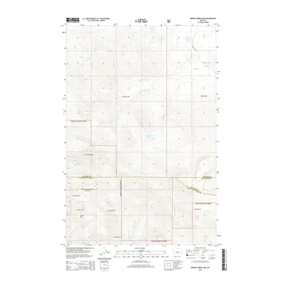
2014 Map of Middle Creek Lake
USGS Topo · Published 2014About this map
Helena National Forest lands dominate this high-altitude landscape where the headwaters of several drainages diverge across the continental divide. The terrain is defined by dramatic elevation changes, notably at Moors Mtn and along the spine of Shellrock Ridge. Water management and natural catchment are central to the area's character, with Middle Creek Lake and Cannon Lake serving as primary landmarks. The map shows a transition of mountain stream networks, where Middle Cr and the W Fork Middle Cr carve through deep valleys like Tender Gulch and Hunters Gulch. The intersection of Cascade, Lewis and Clark, and Meagher counties meets here, marking a remote tri-county boundary point within the national forest system where infrastructure is limited to primitive routes like Cannon Lake Ln.
Find a feature on this map
28 named features on this map. Tap any name to fly to it.
Don’t see what you’re looking for? This feature index may not catch every label — zoom into the map to look around manually.
Map Details
Editions of this 2014 Middle Creek Lake Map
This is the sole edition of this map. No revisions or reprints were ever made.
Other maps of this area

1886 · Great Falls
USGS Topo · 1:250,000

1886 · Fort Logan
USGS Topo · 1:250,000

1948 · White Sulphur Springs
USGS Topo · 1:250,000

1954 · Great Falls
USGS Topo · 1:250,000

1957 · Great Falls
USGS Topo · 1:250,000

1958 · White Sulphur Springs
USGS Topo · 1:250,000

1961 · White Sulphur Springs
USGS Topo · 1:250,000

1961 · Hound Creek Reservoir
USGS Topo · 1:24,000

1961 · Dana Ranch
USGS Topo · 1:24,000
1961 · The Sawteeth
USGS Topo · 1:24,000