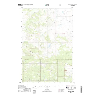
2020 Map of Middle Creek Lake
USGS Topo · Published 2020About this map
Helena National Forest encompasses the high country of this terrain, where the boundary lines of Cascade, Meagher, and Lewis and Clark Counties converge among steep drainages and mountain peaks. The landscape is defined by the headwaters of numerous creeks, notably the winding path of Middle Cr which feeds into the high-elevation Middle Creek Lake. To the north, Cannon Lake sits near the edge of a distinct plateau, while the southern reaches of the map are marked by the dramatic relief of Refrigerator Canyon and Moors Mtn. The orientation of names like Shellrock Ridge and Hunters Gulch suggests a wilderness shaped by traditional access points and natural barriers. This 2020 edition provides an exacting look at the hydrology of the Big Belt Mountains, tracing the intricate network of Porcupine Creek and Willow Creek before they descend into the lower valleys.
Find a feature on this map
31 named features on this map. Tap any name to fly to it.
Don’t see what you’re looking for? This feature index may not catch every label — zoom into the map to look around manually.
Map Details
Editions of this 2020 Middle Creek Lake Map
This is the sole edition of this map. No revisions or reprints were ever made.
Other maps of this area

1886 · Great Falls
USGS Topo · 1:250,000

1886 · Fort Logan
USGS Topo · 1:250,000

1948 · White Sulphur Springs
USGS Topo · 1:250,000

1954 · Great Falls
USGS Topo · 1:250,000

1957 · Great Falls
USGS Topo · 1:250,000

1958 · White Sulphur Springs
USGS Topo · 1:250,000

1961 · White Sulphur Springs
USGS Topo · 1:250,000

1961 · Hound Creek Reservoir
USGS Topo · 1:24,000

1961 · Dana Ranch
USGS Topo · 1:24,000
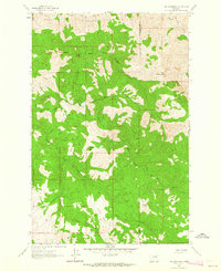
1961 · The Sawteeth
USGS Topo · 1:24,000