
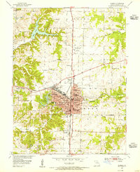
1952 Map of Middle Grove
USGS Topo · Published 1955About this map
The Elk Fork Salt River and its various tributaries, including Coon Creek and Galbreath Creek, carve a detailed drainage pattern across this section of central Missouri. Small rural settlements such as Middle Grove, Milton, and Evansville serve as focal points for the surrounding agricultural townships of Union, Marion, and Prairie. The landscape is dotted with foundational community institutions, including the Number Six Sch, Stony Point Sch, and Antioch Ch, reflecting the distributed nature of early mid-century rural life.
Find a feature on this map
27 named features on this map. Tap any name to fly to it.
Don’t see what you’re looking for? This feature index may not catch every label — zoom into the map to look around manually.
Map Details
Editions of this 1952 Middle Grove Map
This is the sole edition of this map. No revisions or reprints were ever made.
Other maps of this area

1890 · Moberly
USGS Topo · 1:125,000

1908 · Macon
USGS Topo · 1:62,500

1910 · Macon
USGS Topo · 1:62,500

1953 · Moberly
USGS Topo · 1:250,000

1953 · Renick
USGS Topo · 1:24,000

1953 · Clark
USGS Topo · 1:24,000
1953 · Moberly
USGS Topo · 1:24,000

1954 · Moberly
USGS Topo · 1:250,000

1957 · Moberly
USGS Topo · 1:250,000

1958 · Tulip
USGS Topo · 1:24,000