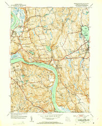
1952 Map of Middle Haddam
USGS Topo · Published 1953About this map
The Connecticut River winds through this mid-century landscape, defining the boundaries between Portland, Middletown, and Haddam. This survey documents a period of established riverfront industry and local infrastructure, showing the New York New Haven and Hartford railroad following the river’s curves and cutting inland toward East Hampton. The map is particularly detailed regarding local landmarks and institutions, including St Clements Castle and multiple scouting locations like Camp Sprague and Camp Terramugus.
Find a feature on this map
86 named features on this map. Tap any name to fly to it.
Don’t see what you’re looking for? This feature index may not catch every label — zoom into the map to look around manually.
Map Details
Editions of this 1952 Middle Haddam Map
3 editions found
Other maps of this area

1892 · Gilead
USGS Topo · 1:62,500

1893 · Guilford
USGS Topo · 1:62,500

1893 · Middletown
USGS Topo · 1:62,500

1893 · Saybrook
USGS Topo · 1:62,500

1906 · Farmington
USGS Topo · 1:125,000

1928 · Cromwell
USGS Topo · 1:24,000

1928 · Glastonbury
USGS Topo · 1:24,000

1943 · Durham
USGS Topo · 1:25,000

1944 · Hartford South
USGS Topo · 1:31,680

1944 · Marlboro
USGS Topo · 1:31,680