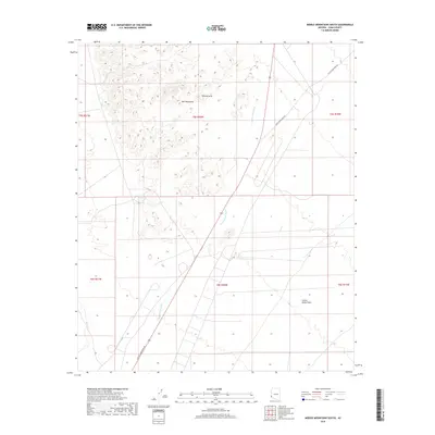
2018 Map of Middle Mountains South
USGS Topo · Published 2018About this map
The Mid Mountains dominate the northwestern portion of this arid Yuma County landscape, where steep topography transitions into the expansive Castle Dome Plain. This desert environment is characterized by large drainage systems such as Castle Dome Wash, which cuts a broad path through the central valley. A prominent Natural Arch is located among the high ridges, serving as a distinct natural landmark in this sparsely populated region. Human activity is primarily represented by the Castle Dome Mine Rd, which traverses the rugged terrain and links the area to historical mining operations beyond the quadrangle borders. The map detail reflects a classic desert Basin and Range land use pattern, where development is dictated by the passage of washes and the accessibility of mineral-rich mountain passes.
Find a feature on this map
11 named features on this map. Tap any name to fly to it.
Don’t see what you’re looking for? This feature index may not catch every label — zoom into the map to look around manually.
Map Details
Editions of this 2018 Middle Mountains South Map
This is the sole edition of this map. No revisions or reprints were ever made.
Other maps of this area

1929 · Laguna
USGS Topo · 1:62,500

1939 · Red Hill
USGS Topo · 1:62,500

1942 · Yuma
USGS Topo · 1:250,000

1942 · Blythe
USGS Topo · 1:250,000

1943 · Laguna
USGS Topo · 1:62,500

1954 · El Centro
USGS Topo · 1:250,000

1954 · Salton Sea
USGS Topo · 1:250,000

1954 · Red Hill
USGS Topo · 1:62,500

1955 · Salton Sea
USGS Topo · 1:250,000

1955 · El Centro
USGS Topo · 1:250,000