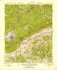
1927 Map of Middlesboro
USGS Topo · Published 1955About this map
Middlesboro anchors this 1920s topography, situated at the historic junction of Kentucky, Tennessee, and Virginia. The landscape is dominated by the massive ridge of Brush Mountain and the iconic passage at Cumberland Gap, overlooked by the heights of The Pinnacle. The map details a complex network of early 20th-century transportation and settlement, including the Louisville and Nashville RR and Southern Ry winding through the gaps.
Find a feature on this map
96 named features on this map. Tap any name to fly to it.
Don’t see what you’re looking for? This feature index may not catch every label — zoom into the map to look around manually.
Map Details
Editions of this 1927 Middlesboro Map
This is the sole edition of this map. No revisions or reprints were ever made.
Other maps of this area

1883 · Morristown
USGS Topo · 1:125,000

1886 · Cumberland Gap
USGS Topo · 1:125,000

1887 · Jonesville
USGS Topo · 1:125,000

1888 · Cumberland Gap
USGS Topo · 1:125,000

1891 · Cumberland Gap
USGS Topo · 1:125,000

1891 · Jonesville
USGS Topo · 1:125,000

1893 · Morristown
USGS Topo · 1:125,000

1895 · Morristown
USGS Topo · 1:125,000

1897 · Maynardville
USGS Topo · 1:125,000

1900 · Maynardville
USGS Topo · 1:125,000