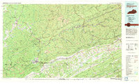
1977 Map of Middlesboro
USGS Topo · Published 1983About this map
Cumberland Gap National Historical Park anchors this 1970s landscape where the borders of Kentucky, Tennessee, and Virginia converge. This era shows the dense infrastructure of the Appalachian coal country, with the Louisville and Nashville RR and Southern Railway following the tight valleys alongside the Cumberland River and Powell River. The map captures the significant elevation changes of the Pine Mountain and Cumberland Mountain ridges, which dictate the placement of settlements like Middlesboro and Harlan.
Find a feature on this map
91 named features on this map. Tap any name to fly to it.
Don’t see what you’re looking for? This feature index may not catch every label — zoom into the map to look around manually.
Map Details
Editions of this 1977 Middlesboro Map
This is the sole edition of this map. No revisions or reprints were ever made.
Other maps of this area

1883 · Morristown
USGS Topo · 1:125,000

1886 · Cumberland Gap
USGS Topo · 1:125,000

1887 · Jonesville
USGS Topo · 1:125,000

1888 · Cumberland Gap
USGS Topo · 1:125,000

1890 · Whitesburg
USGS Topo · 1:125,000

1890 · Williamsburg
USGS Topo · 1:125,000

1891 · Manchester
USGS Topo · 1:125,000

1891 · Cumberland Gap
USGS Topo · 1:125,000

1891 · Hazard
USGS Topo · 1:125,000

1891 · Jonesville
USGS Topo · 1:125,000