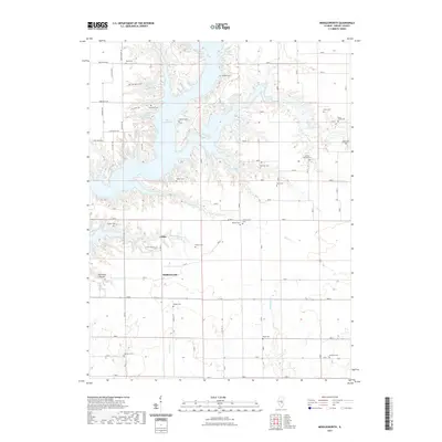
2021 Map of Middlesworth
USGS Topo · Published 2021About this map
Lake Shelbyville dominates the northern landscape of this Shelby County study, its irregular fingers reaching into the surrounding rural townships. The settlement of Lithia and the namesake village of Middlesworth sit south of the water, connected by a network of section roads like Co HWY 4 and Lithia Heights Rd. The area is characterized by an exceptionally high density of small, family-named burial grounds, such as Caldwell Cem, Quigley Cem, and Sulphur Springs Cem, which provide a detailed record of the region's early farming families. Numerous waterways like Richland Cr and Skull Cr carve through the terrain, while McGillian Hollow marks a distinct topographic break to the west. This modern survey illustrates the persistent rural character of central Illinois, where small hamlets and ancestral cemeteries remain central features of the landscape.
Find a feature on this map
79 named features on this map. Tap any name to fly to it.
Don’t see what you’re looking for? This feature index may not catch every label — zoom into the map to look around manually.
Map Details
Editions of this 2021 Middlesworth Map
This is the sole edition of this map. No revisions or reprints were ever made.
Other maps of this area

1935 · Sullivan
USGS Topo · 1:48,000

1940 · Sullivan
USGS Topo · 1:62,500

1942 · Shelbyville
USGS Topo · 1:62,500

1946 · Shelbyville
USGS Topo · 1:62,500

1947 · Stewardson
USGS Topo · 1:62,500

1949 · Stewardson
USGS Topo · 1:62,500

1949 · Dalton City
USGS Topo · 1:62,500

1958 · Decatur
USGS Topo · 1:250,000

1961 · Decatur
USGS Topo · 1:250,000

1980 · Middlesworth
USGS Topo · 1:24,000