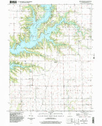
1999 Map of Middlesworth
USGS Topo · Published 2003About this map
Lake Shelbyville dominates the northern landscape of this map, its sprawling waters drowning the old course of the Kaskaskia River and forming deep inlets like Lithia Springs Cove and Eagle Nest Cove. The creation of the reservoir transformed the region into a recreational hub, evidenced by the establishment of Eagle Creek State Park and Wolf Creek State Park along its wooded peninsulas.
Find a feature on this map
46 named features on this map. Tap any name to fly to it.
Don’t see what you’re looking for? This feature index may not catch every label — zoom into the map to look around manually.
Map Details
Editions of this 1999 Middlesworth Map
This is the sole edition of this map. No revisions or reprints were ever made.
Other maps of this area

1935 · Sullivan
USGS Topo · 1:48,000

1940 · Sullivan
USGS Topo · 1:62,500

1942 · Shelbyville
USGS Topo · 1:62,500

1946 · Shelbyville
USGS Topo · 1:62,500

1947 · Stewardson
USGS Topo · 1:62,500

1949 · Stewardson
USGS Topo · 1:62,500

1949 · Dalton City
USGS Topo · 1:62,500

1958 · Decatur
USGS Topo · 1:250,000

1961 · Decatur
USGS Topo · 1:250,000

1980 · Middlesworth
USGS Topo · 1:24,000