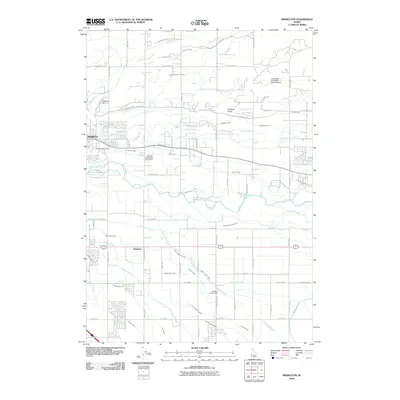
2010 Map of Middleton
USGS Topo · Published 2010About this map
The Boise River carves through the center of this landscape, its path defined by an intricate network of irrigation systems and drainage channels essential to local agriculture. The settlement of Middleton occupies the northwest, where the North Middleton Drain and South Middleton Drain manage the water table. To the south, the community of Maddens sits near the Caldwell High Line Canal, illustrating how 20th-century water engineering reshaped the high desert into productive farmland.
Find a feature on this map
76 named features on this map. Tap any name to fly to it.
Don’t see what you’re looking for? This feature index may not catch every label — zoom into the map to look around manually.
Map Details
Editions of this 2010 Middleton Map
This is the sole edition of this map. No revisions or reprints were ever made.
Other maps of this area

1892 · Boise
USGS Topo · 1:125,000

1897 · Boise
USGS Topo · 1:125,000

1898 · Nampa
USGS Topo · 1:125,000

1953 · Meridian
USGS Topo · 1:24,000

1953 · Star
USGS Topo · 1:24,000

1953 · Montour
USGS Topo · 1:62,500

1955 · Boise
USGS Topo · 1:250,000

1958 · Boise
USGS Topo · 1:250,000
1958 · Middleton
USGS Topo · 1:24,000
1958 · Lake Lowell
USGS Topo · 1:24,000