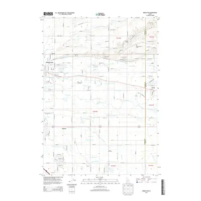
2013 Map of Middleton
USGS Topo · Published 2013About this map
The Boise River valley defines the character of this Idaho landscape, where a sophisticated network of irrigation infrastructure supports the agricultural plains of Canyon and Ada counties. The town of Middleton sits at the heart of this web, flanked by the Middleton Canal and Mill Slough. This 2013 survey illustrates the density of the region's water management, featuring dozens of named laterals, drains, and ditches such as the Caldwell High Line Canal and Phyllis Slough.
Find a feature on this map
108 named features on this map. Tap any name to fly to it.
Don’t see what you’re looking for? This feature index may not catch every label — zoom into the map to look around manually.
Map Details
Editions of this 2013 Middleton Map
This is the sole edition of this map. No revisions or reprints were ever made.
Other maps of this area

1892 · Boise
USGS Topo · 1:125,000

1897 · Boise
USGS Topo · 1:125,000

1898 · Nampa
USGS Topo · 1:125,000

1953 · Meridian
USGS Topo · 1:24,000

1953 · Star
USGS Topo · 1:24,000

1953 · Montour
USGS Topo · 1:62,500

1955 · Boise
USGS Topo · 1:250,000

1958 · Boise
USGS Topo · 1:250,000
1958 · Middleton
USGS Topo · 1:24,000
1958 · Lake Lowell
USGS Topo · 1:24,000