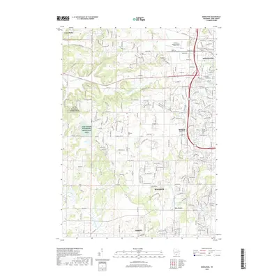
2018 Map of Middleton
USGS Topo · Published 2018About this map
Middleton and the western reaches of Madison define this 2018 survey, showing the continued expansion of suburban Dane County. The map provides a detailed view of Middleton Junction and Five Points, while highlighting the transition from developed neighborhoods to managed natural spaces. To the west, the Ice Age National Scenic Trail winds through the landscape, bordering the Dane County Waterfowl Production Area. This era's infrastructure is dominated by the Middleton Municipal Airport - Morey Field and a dense network of residential streets. Genealogists can locate numerous burial grounds across the quadrangle, including Middleton Cem, Sunset Memory Gardens, and several church-affiliated sites like Saint John's Cem and Saint Luke's Lutheran Cem. Water features such as Black Earth Cr and Sugar River anchor the drainage patterns of the region's western edge.
Find a feature on this map
269 named features on this map. Tap any name to fly to it.
Don’t see what you’re looking for? This feature index may not catch every label — zoom into the map to look around manually.
Map Details
Editions of this 2018 Middleton Map
This is the sole edition of this map. No revisions or reprints were ever made.
Other maps of this area

1889 · Evansville
USGS Topo · 1:62,500

1890 · Madison
USGS Topo · 1:62,500

1892 · Madison
USGS Topo · 1:62,500

1894 · Evansville
USGS Topo · 1:62,500

1904 · Madison
USGS Topo · 1:62,500

1906 · Evansville
USGS Topo · 1:62,500

1906 · Madison
USGS Topo · 1:62,500

1907 · Cross Plains
USGS Topo · 1:62,500

1909 · Cross Plains
USGS Topo · 1:62,500

1923 · New Glarus
USGS Topo · 1:62,500