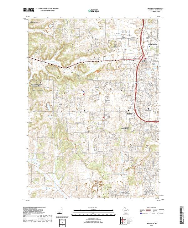
2022 Map of Middleton
USGS Topo · Published 2022About this map
Middleton and the surrounding Dane County landscape are defined by a mix of established residential neighborhoods, industrial rail corridors, and extensive glacial topography. The Wisconsin & Southern RR cuts through the heart of the area, passing Middleton Junction and serving the commercial core. This modern survey illustrates the proximity of dense urban development in Madison to significant natural conservation efforts, including the Ice Age National Scenic Trail and the Dane County Waterfowl Production Area.
Find a feature on this map
237 named features on this map. Tap any name to fly to it.
Don’t see what you’re looking for? This feature index may not catch every label — zoom into the map to look around manually.
Map Details
Editions of this 2022 Middleton Map
This is the sole edition of this map. No revisions or reprints were ever made.