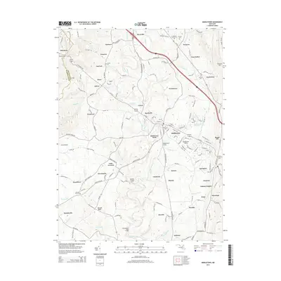
2014 Map of Middletown
USGS Topo · Published 2014About this map
Middletown and Myersville anchor this study of western Frederick County, where the topography is defined by the sharp rise of Catoctin Mtn to the east and the gaps through the ridge to the west. The landscape is a dense network of small family-named settlements like Frostown, Bolivar, and Hawbottom, each connected by historic thoroughfares such as the Old National Pike. Genealogical interest is particularly high here, with numerous burial sites including Harmony Brethren Cem, Mt Tabor Cem, and Johnson Cem scattered among the rural hamlets. The drainage patterns of Catoctin Creek and its many tributaries, such as Wiles Br and Bolivar Br, dictate the placement of local infrastructure, including the Bennies Hill Road Bridge and Poffenberger Road Bridge. Further west, the Appalachian National Scenic Trail traverses the ridgeline near Turners Gap and Fox Gap, marking the boundary with Washington County.
Find a feature on this map
84 named features on this map. Tap any name to fly to it.
Don’t see what you’re looking for? This feature index may not catch every label — zoom into the map to look around manually.
Map Details
Editions of this 2014 Middletown Map
This is the sole edition of this map. No revisions or reprints were ever made.
Other maps of this area

1884 · Harpers Ferry
USGS Topo · 1:125,000

1891 · Harpers Ferry
USGS Topo · 1:125,000

1893 · Frederick
USGS Topo · 1:125,000

1893 · Harpers Ferry
USGS Topo · 1:125,000

1894 · Frederick
USGS Topo · 1:125,000

1908 · Middletown
USGS Topo · 1:48,000

1908 · Ijamsville
USGS Topo · 1:62,500

1909 · Ijamsville
USGS Topo · 1:62,500

1909 · Hagerstown
USGS Topo · 1:48,000

1910 · Antietam
USGS Topo · 1:62,500