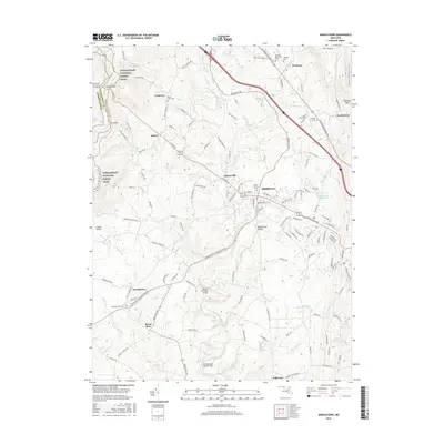
2016 Map of Middletown
USGS Topo · Published 2016About this map
The Middletown Valley is the focal point of this Frederick County survey, where the township of Middletown sits as a central hub along the Baltimore National Pike. The landscape is defined by the high ground of Catoctin Mtn to the east and the ridge carrying the Appalachian National Scenic Trail to the west. This upland geography created strategic passages such as Turners Gap and Fox Gap, while the valley floor is etched by the complex drainage of Catoctin Creek and its many tributaries, including Middle Cr and Grindstone Run. Numerous small settlements and rural crossroads like Frostown, Bolivar, Spoolsville, and Arnoldtown are scattered throughout, often anchored by local landmarks like the Zion Lutheran Cem or family-named plots such as the Johnson Cem. The road network connects these historic hamlets across Bennies Hill Road Bridge and Poffenberger Road Bridge, reflecting a long-standing agricultural and transport corridor.
Find a feature on this map
136 named features on this map. Tap any name to fly to it.
Don’t see what you’re looking for? This feature index may not catch every label — zoom into the map to look around manually.
Map Details
Editions of this 2016 Middletown Map
This is the sole edition of this map. No revisions or reprints were ever made.
Other maps of this area

1884 · Harpers Ferry
USGS Topo · 1:125,000

1891 · Harpers Ferry
USGS Topo · 1:125,000

1893 · Frederick
USGS Topo · 1:125,000

1893 · Harpers Ferry
USGS Topo · 1:125,000

1894 · Frederick
USGS Topo · 1:125,000

1908 · Middletown
USGS Topo · 1:48,000

1908 · Ijamsville
USGS Topo · 1:62,500

1909 · Ijamsville
USGS Topo · 1:62,500

1909 · Hagerstown
USGS Topo · 1:48,000

1910 · Antietam
USGS Topo · 1:62,500