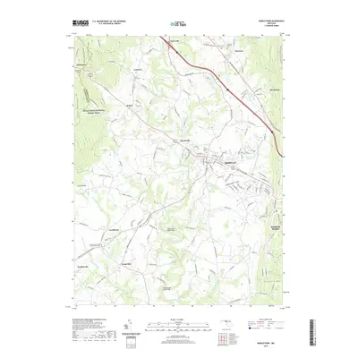
2019 Map of Middletown
USGS Topo · Published 2019About this map
Middletown serves as the central hub of this Frederick County landscape, where the Old National Pike and Middletown Pkwy converge. The area's deep roots are visible through numerous burial grounds, including the Middletown Cem and Zion Lutheran Cem, reflecting a long-standing community structure. To the west, the Appalachian National Scenic Trail traces the ridgeline of South Mountain, while Catoctin Mtn rises to the east, creating a distinct valley corridor. Smaller settlements like Myersville, Wolfsville, and Burkittsville are connected by a network of runs and creeks, such as Catoctin Creek and Little Catoctin Cr. Infrastructure like the Bennies Hill Road Bridge and the Middletown Reservoir highlights the managed water and transportation systems that support these valley townships.
Find a feature on this map
49 named features on this map. Tap any name to fly to it.
Don’t see what you’re looking for? This feature index may not catch every label — zoom into the map to look around manually.
Map Details
Editions of this 2019 Middletown Map
This is the sole edition of this map. No revisions or reprints were ever made.
Other maps of this area

1884 · Harpers Ferry
USGS Topo · 1:125,000

1891 · Harpers Ferry
USGS Topo · 1:125,000

1893 · Frederick
USGS Topo · 1:125,000

1893 · Harpers Ferry
USGS Topo · 1:125,000

1894 · Frederick
USGS Topo · 1:125,000

1908 · Middletown
USGS Topo · 1:48,000

1908 · Ijamsville
USGS Topo · 1:62,500

1909 · Ijamsville
USGS Topo · 1:62,500

1909 · Hagerstown
USGS Topo · 1:48,000

1910 · Antietam
USGS Topo · 1:62,500