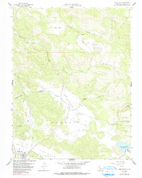
1958 Map of Middletown
USGS Topo · Published 1991About this map
Middletown serves as the primary settlement hub in this 1958 survey of Lake County, situated at the confluence of St. Helena Road and local transit routes. The landscape is defined by a series of distinct upland basins, including Collayomi Valley, Guenoc Valley, and the elongated Coyote Valley. These agricultural and pastoral lands are interconnected by Coyote Creek and Putah Creek, which drain the surrounding highlands toward McCreary Lake in the southeast.
Find a feature on this map
34 named features on this map. Tap any name to fly to it.
Don’t see what you’re looking for? This feature index may not catch every label — zoom into the map to look around manually.
Map Details
Editions of this 1958 Middletown Map
3 editions found
Other maps of this area

1927 · Calistoga
USGS Topo · 1:62,500

1942 · St. Helena
USGS Topo · 1:62,500

1943 · Morgan Valley
USGS Topo · 1:62,500

1943 · Calistoga
USGS Topo · 1:62,500

1944 · Morgan Valley
USGS Topo · 1:62,500

1945 · Calistoga
USGS Topo · 1:62,500

1945 · St. Helena
USGS Topo · 1:62,500

1945 · Lower Lake
USGS Topo · 1:62,500

1947 · Santa Rosa
USGS Topo · 1:250,000

1949 · Santa Rosa
USGS Topo · 1:250,000