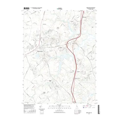
2016 Map of Middletown
USGS Topo · Published 2016About this map
Middletown serves as the central hub of this northern Delaware landscape, where the suburban expansion of the Delmarva Peninsula meets a legacy of agricultural and maritime history. The town is surrounded by several satellite settlements including Odessa, Townsend, and Armstrong, linked by the prominent corridor of the S Dupont Pkwy. The mapping of numerous local graveyards, such as Saint Annes Cem, Forest Cem, and Drawyer Cem, provides a detailed geographic record for genealogical research in New Castle County.
Find a feature on this map
213 named features on this map. Tap any name to fly to it.
Don’t see what you’re looking for? This feature index may not catch every label — zoom into the map to look around manually.
Map Details
Editions of this 2016 Middletown Map
This is the sole edition of this map. No revisions or reprints were ever made.
Other maps of this area

1898 · Elkton
USGS Topo · 1:62,500

1899 · Dover
USGS Topo · 1:125,000

1900 · Elkton
USGS Topo · 1:62,500

1900 · Cecilton
USGS Topo · 1:62,500

1904 · Wilmington
USGS Topo · 1:62,500

1906 · Dover
USGS Topo · 1:125,000

1906 · Wilmington
USGS Topo · 1:62,500

1917 · Elkton
USGS Topo · 1:62,500

1919 · Wilmington
USGS Topo · 1:62,500

1920 · Dover
USGS Topo · 1:125,000