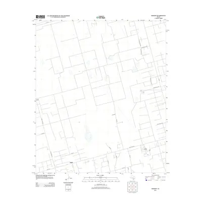
2013 Map of Midkiff
USGS Topo · Published 2013About this map
Midkiff and its surrounding Upton County landscape are defined by the intricate infrastructure of the West Texas energy industry during the early 21st century. The map reveals a dense network of county and private roads that support regional operations, most notably the Midkiff Gas Plant. These transportation corridors, including Ranch Road 3095 and Ranch Road 2401, cut through the terrain in a systematic grid typical of the Permian Basin's developed oil and gas fields. The transition from the more established Midkiff settlement to the specialized Midkiff Camp area highlights the area's functional character. Further connectivity is provided by state routes like Fm-1379 and Fm-1357, which link this industrial hub to the broader Texas highway system. The presence of smaller local markers such as Pecan adds a layer of community identity amidst the widespread industrial footprint.
Find a feature on this map
24 named features on this map. Tap any name to fly to it.
Don’t see what you’re looking for? This feature index may not catch every label — zoom into the map to look around manually.
Map Details
Editions of this 2013 Midkiff Map
This is the sole edition of this map. No revisions or reprints were ever made.
Other maps of this area

1954 · San Angelo
USGS Topo · 1:250,000

1958 · San Angelo
USGS Topo · 1:250,000

1965 · San Angelo
USGS Topo · 1:250,000

1965 · Salt Lake
USGS Topo · 1:24,000

1965 · Pecks Lake
USGS Topo · 1:24,000

1965 · Patterson Lake
USGS Topo · 1:24,000

1967 · Midkiff
USGS Topo · 1:24,000

1968 · Midkiff NW
USGS Topo · 1:24,000

1968 · Midkiff SW
USGS Topo · 1:24,000

1968 · Midkiff SE
USGS Topo · 1:24,000