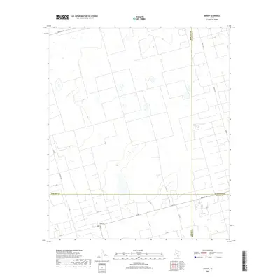
2019 Map of Midkiff
USGS Topo · Published 2019About this map
The settlement of Midkiff serves as the focal point of this West Texas landscape, where the borders of four counties—Midland, Glasscock, Upton, and Reagan—converge in a geometric grid of ranch roads and section lines. This survey captures the region's essential character as a crossroads of the Permian Basin, dominated by an expansive network of rural transit corridors such as FM 2401 and Farm Rd 1357. The terrain is marked by numerous small depressions and basins, typical of the high plains drainage patterns, interspersed with local landmarks like the route along Pecan. To the north, Ranch Rd 1379 skirts the county line, while FM 3095 and Ranch Rd 3095 provide critical north-south access through the arid ranch lands. The map documents the precise intersection of administrative boundaries, including the Midland and Upton County line, which shapes the development and road layout of the area.
Find a feature on this map
21 named features on this map. Tap any name to fly to it.
Don’t see what you’re looking for? This feature index may not catch every label — zoom into the map to look around manually.
Map Details
Editions of this 2019 Midkiff Map
This is the sole edition of this map. No revisions or reprints were ever made.
Other maps of this area

1954 · San Angelo
USGS Topo · 1:250,000

1958 · San Angelo
USGS Topo · 1:250,000

1965 · San Angelo
USGS Topo · 1:250,000

1965 · Salt Lake
USGS Topo · 1:24,000

1965 · Pecks Lake
USGS Topo · 1:24,000

1965 · Patterson Lake
USGS Topo · 1:24,000

1967 · Midkiff
USGS Topo · 1:24,000

1968 · Midkiff NW
USGS Topo · 1:24,000

1968 · Midkiff SW
USGS Topo · 1:24,000

1968 · Midkiff SE
USGS Topo · 1:24,000