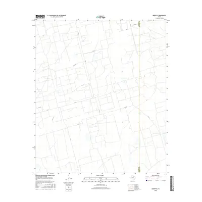
2016 Map of Midkiff SE
USGS Topo · Published 2016About this map
The high plains of the Permian Basin are defined here by a geometric network of ranch roads and county lines. Stretching across the border between Upton and Reagan Counties, the landscape is primarily organized around long-distance corridors like FM 2401 and FM 2594. Unlike many regions where roads follow the natural contours of the land, this 2016 survey shows a grid-like precision typical of West Texas ranching and energy country. Local access is facilitated by numerous county roads, including Co Rd 126 and Co Rd 128, while distinctive local names like Bamboo, Pecan, and Fathergilla appear as specific destination points or small-scale landmarks in the northern portion of the quadrangle. This map documents the infrastructure supporting the vast agricultural and resource-based economy of the Edwards Plateau region.
Find a feature on this map
14 named features on this map. Tap any name to fly to it.
Don’t see what you’re looking for? This feature index may not catch every label — zoom into the map to look around manually.
Map Details
Editions of this 2016 Midkiff SE Map
This is the sole edition of this map. No revisions or reprints were ever made.
Other maps of this area

1928 · Rankin
USGS Topo · 1:125,000

1954 · San Angelo
USGS Topo · 1:250,000

1958 · San Angelo
USGS Topo · 1:250,000

1965 · San Angelo
USGS Topo · 1:250,000

1967 · Midkiff
USGS Topo · 1:24,000

1968 · Midkiff NW
USGS Topo · 1:24,000

1968 · Midkiff SW
USGS Topo · 1:24,000

1968 · Midkiff SE
USGS Topo · 1:24,000

1970 · Sevenmile Corner NE
USGS Topo · 1:24,000

1970 · Stiles NW
USGS Topo · 1:24,000