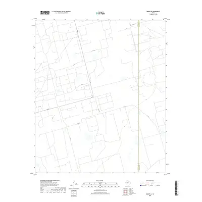
2019 Map of Midkiff SE
USGS Topo · Published 2019About this map
The Upton Co Reagan Co boundary line bisects this section of the Permian Basin, where the landscape is defined by a dense, geometric network of industrial access roads and energy infrastructure. The terrain is characterized by a pattern of numerous small depressions and basins, typical of the high plains of West Texas. A web of secondary routes, including Fm 2401 and Fm 2594, provides access across the arid landscape, while several local roads such as Bamboo, Pecan, and Fathergilla appear in the northern reaches of the quadrangle. This 2019 survey documents the extensive modification of the land for oil and gas extraction, as seen in the grid-like distribution of roads like Co Rd 126 and Co Rd 128, which crisscross the otherwise open and sparsely populated county line region.
Find a feature on this map
14 named features on this map. Tap any name to fly to it.
Don’t see what you’re looking for? This feature index may not catch every label — zoom into the map to look around manually.
Map Details
Editions of this 2019 Midkiff SE Map
This is the sole edition of this map. No revisions or reprints were ever made.
Other maps of this area

1928 · Rankin
USGS Topo · 1:125,000

1954 · San Angelo
USGS Topo · 1:250,000

1958 · San Angelo
USGS Topo · 1:250,000

1965 · San Angelo
USGS Topo · 1:250,000

1967 · Midkiff
USGS Topo · 1:24,000

1968 · Midkiff NW
USGS Topo · 1:24,000

1968 · Midkiff SW
USGS Topo · 1:24,000

1968 · Midkiff SE
USGS Topo · 1:24,000

1970 · Sevenmile Corner NE
USGS Topo · 1:24,000

1970 · Stiles NW
USGS Topo · 1:24,000