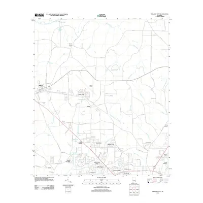
2011 Map of Midland City
USGS Topo · Published 2011About this map
Midland City and the neighboring aviation hub at Dothan Airport anchor this southeastern Alabama landscape, where residential development meets the traditional drainage systems of the Choctawhatchee basin. The map reveals a cluster of established communities including Napier Field, Grimes, and the smaller residential pockets of Grand Acres and Denton Acres. This era shows a transition from rural agricultural land toward suburban expansion, though the area maintains its local heritage through sites like Magnolia Cemetery and Bethlehem Cemetery. The Little Choctawhatchee River and its many tributaries, such as Murphy Mill Branch and Harrison Mill Creek, form a complex network of waterways that define the local topography. Further south, the presence of the Dothan Prison Camp and the Tri-State Fair and Exposition grounds indicate the diverse land use in the outskirts of the Dothan metropolitan area, balancing industrial and civic functions with quiet settlements like Sylvan Grove.
Find a feature on this map
113 named features on this map. Tap any name to fly to it.
Don’t see what you’re looking for? This feature index may not catch every label — zoom into the map to look around manually.
Map Details
Editions of this 2011 Midland City Map
This is the sole edition of this map. No revisions or reprints were ever made.
Other maps of this area

1942 · Enterprise
USGS Topo · 1:125,000

1948 · Ozark
USGS Topo · 1:62,500

1950 · Ozark
USGS Topo · 1:62,500

1953 · Dothan
USGS Topo · 1:250,000

1954 · Dothan
USGS Topo · 1:250,000

1955 · Dothan
USGS Topo · 1:250,000

1957 · Malvern
USGS Topo · 1:24,000

1957 · Hartford
USGS Topo · 1:62,500

1960 · Ewell
USGS Topo · 1:24,000

1960 · Pinckard
USGS Topo · 1:24,000