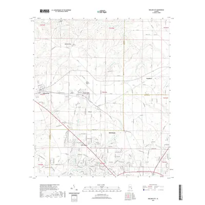
2020 Map of Midland City
USGS Topo · Published 2020About this map
Dothan and its northern suburbs are characterized by a dense intersection of road networks and local watersheds in this 2020 record. The landscape is defined by the Little Choctawhatchee River and its various tributaries, such as Murphy Mill Br and Harrison Mill Cr, which cut through the terrain surrounding the Dothan Regional Airport. Key educational and community landmarks like Wallace Community College and Troy State University Dothan Trails sit between the established settlements of Midland City and Grimes. Several prominent burial grounds, including Sylvan Grove Cem and Magnolia Cem, provide specific points of interest for genealogists tracing family histories in the Wiregrass region. The transition from the more urbanized southern edge to the agricultural northern reaches near Sylvan Grove is clearly marked by the county lines between Houston, Dale, and Henry counties.
Find a feature on this map
174 named features on this map. Tap any name to fly to it.
Don’t see what you’re looking for? This feature index may not catch every label — zoom into the map to look around manually.
Map Details
Editions of this 2020 Midland City Map
This is the sole edition of this map. No revisions or reprints were ever made.
Other maps of this area

1942 · Enterprise
USGS Topo · 1:125,000

1948 · Ozark
USGS Topo · 1:62,500

1950 · Ozark
USGS Topo · 1:62,500

1953 · Dothan
USGS Topo · 1:250,000

1954 · Dothan
USGS Topo · 1:250,000

1955 · Dothan
USGS Topo · 1:250,000

1957 · Malvern
USGS Topo · 1:24,000

1957 · Hartford
USGS Topo · 1:62,500

1960 · Ewell
USGS Topo · 1:24,000

1960 · Pinckard
USGS Topo · 1:24,000