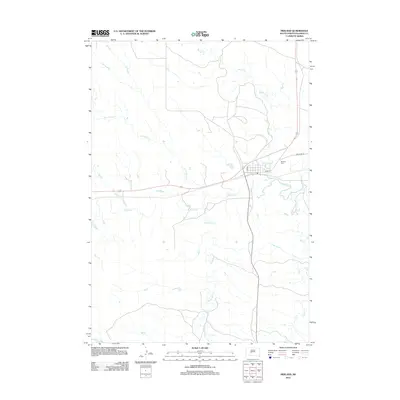
2012 Map of Midland
USGS Topo · Published 2012About this map
Midland serves as the focal point of this Haakon County landscape, situated at the confluence of the Bad River and several significant tributaries. The town layout is defined by its central thoroughfares, including Main St and Elm St, while the Midland Cem is located just to the northeast of the primary settlement area. This region is characterized by an intricate drainage system, with Mitchell Cr, Jack Dailey Cr, and Brave Bull Cr feeding into the river valley. The map documents the rural road network connecting these waterways, including the appropriately named Bad River Rd. The terrain is marked by the distinct draws and basins of Mud Cr and Ash Cr, illustrating the hydraulic patterns of this part of South Dakota.
Find a feature on this map
11 named features on this map. Tap any name to fly to it.
Don’t see what you’re looking for? This feature index may not catch every label — zoom into the map to look around manually.
Map Details
Editions of this 2012 Midland Map
This is the sole edition of this map. No revisions or reprints were ever made.
Other maps of this area

1953 · Belvidere NE
USGS Topo · 1:24,000

1954 · Midland
USGS Topo · 1:24,000

1954 · Nowlin
USGS Topo · 1:24,000

1954 · Midland SE
USGS Topo · 1:24,000

1954 · Pierre
USGS Topo · 1:250,000

1955 · Martin
USGS Topo · 1:250,000

1958 · Pierre
USGS Topo · 1:250,000

1958 · Martin
USGS Topo · 1:250,000

1972 · Stamford NW
USGS Topo · 1:24,000
1972 · Stamford
USGS Topo · 1:24,000