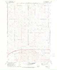
1972 Map of Stamford
USGS Topo · Published 1975About this map
Stamford serves as a focal point in this 1970s landscape, situated along the corridor of the Chicago Milwaukee St Paul and Pacific railroad. The map documents the rural topography across the Haakon and Jackson county lines, where the prairie is defined by the drainage systems of South Creek and Ash Creek. Cultural landmarks are scattered, such as the St Peter Ch and its adjacent Cem, providing specific points of interest for those researching the social fabric of Jones County. The division of the territory into the Morgan and Grand View districts illustrates the administrative organization of this ranching and agricultural region during the early 1970s, as mapped through aerial photogrammetric methods.
Find a feature on this map
10 named features on this map. Tap any name to fly to it.
Don’t see what you’re looking for? This feature index may not catch every label — zoom into the map to look around manually.
Map Details
Editions of this 1972 Stamford Map
This is the sole edition of this map. No revisions or reprints were ever made.
Other maps of this area

1951 · Stamford SW
USGS Topo · 1:24,000

1951 · Capa
USGS Topo · 1:24,000

1951 · Stamford SE
USGS Topo · 1:24,000

1951 · Okaton SW
USGS Topo · 1:24,000

1954 · Midland
USGS Topo · 1:24,000

1954 · Midland SE
USGS Topo · 1:24,000

1954 · Pierre
USGS Topo · 1:250,000

1955 · Martin
USGS Topo · 1:250,000

1958 · Pierre
USGS Topo · 1:250,000

1958 · Martin
USGS Topo · 1:250,000