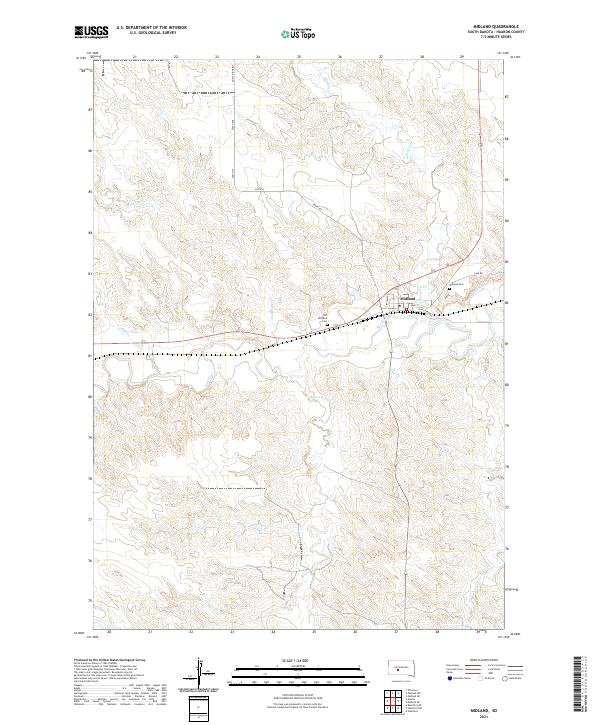
2021 Map of Midland
USGS Topo · Published 2021About this map
The town of Midland serves as the focal point of this 2021 survey, situated at the confluence of several key drainages in Haakon County. The Bad River flows through the center of the sheet, joined by Mitchell Cr and Mud Cr, defining the local topography and historical travel routes. The street grid of the settlement is clearly delineated, showing the commercial and residential core around Main St and Elm St, which provides a clear view of the town's modern footprint in relation to its historical layout.
Find a feature on this map
22 named features on this map. Tap any name to fly to it.
Don’t see what you’re looking for? This feature index may not catch every label — zoom into the map to look around manually.
Map Details
Editions of this 2021 Midland Map
This is the sole edition of this map. No revisions or reprints were ever made.
Other maps of this area

1953 · Belvidere NE
USGS Topo · 1:24,000

1954 · Midland
USGS Topo · 1:24,000

1954 · Nowlin
USGS Topo · 1:24,000

1954 · Midland SE
USGS Topo · 1:24,000

1954 · Pierre
USGS Topo · 1:250,000

1955 · Martin
USGS Topo · 1:250,000

1958 · Pierre
USGS Topo · 1:250,000

1958 · Martin
USGS Topo · 1:250,000

1972 · Stamford NW
USGS Topo · 1:24,000
1972 · Stamford
USGS Topo · 1:24,000