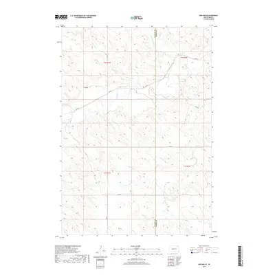
2017 Map of Midland SE
USGS Topo · Published 2017About this map
The Bad River meanders across the northern reaches of this West River landscape, defining the drainage patterns for a series of intermittent tributaries. Significant watercourses such as Lone Tree Creek and Little Prairie Dog Creek feed into the river from the high plains, while landforms like T-M Draw break the upland topography. The map illustrates a rural section of the Haakon County and Jones County line, where the rectangular survey system is clearly visible through the alignment of section roads. Modern transportation infrastructure is limited to localized routes like Capa Road and numbered section lines such as 233rd Street and 252nd Street. This 2017 edition provides a precise look at the contemporary hydrology and rural road network in a sparsely populated region of South Dakota where the high plains transition into the river valley.
Find a feature on this map
15 named features on this map. Tap any name to fly to it.
Don’t see what you’re looking for? This feature index may not catch every label — zoom into the map to look around manually.
Map Details
Editions of this 2017 Midland SE Map
This is the sole edition of this map. No revisions or reprints were ever made.
Other maps of this area

1951 · Capa
USGS Topo · 1:24,000

1951 · Capa NW
USGS Topo · 1:24,000

1954 · Midland
USGS Topo · 1:24,000

1954 · Midland SE
USGS Topo · 1:24,000

1954 · Pierre
USGS Topo · 1:250,000

1955 · Martin
USGS Topo · 1:250,000

1958 · Pierre
USGS Topo · 1:250,000

1958 · Martin
USGS Topo · 1:250,000

1972 · Okaton
USGS Topo · 1:24,000

1972 · Stamford NW
USGS Topo · 1:24,000