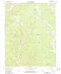
1966 Map of Midridge
USGS Topo · Published 1983About this map
Clark National Forest encompasses much of this Ozark landscape, where the settlements of Midridge and Rat sit among a dense network of hollows and springs. The topography is defined by significant water sources like Big Creek and Logan Creek, which draw deep incisions through Polk Ridge and Cedar Point. Local life in the mid-1960s was centered around rural congregations and remote landmarks, including the Sweetwater Ch, Polk Ch, and the Himont Lookout Tower. The presence of the Adair Creek Mine and a Sewage Disposal Pond near Adair Creek points to the area's industrial and infrastructure development during this period. For those tracing family histories or geological features, the map reveals numerous named springs such as Laxton Spring and Alec Spring, alongside notable natural sites like Laxton Cave.
Find a feature on this map
43 named features on this map. Tap any name to fly to it.
Don’t see what you’re looking for? This feature index may not catch every label — zoom into the map to look around manually.
Map Details
Editions of this 1966 Midridge Map
3 editions found
Other maps of this area

1915 · Eminence
USGS Topo · 1:62,500

1917 · Eminence
USGS Topo · 1:62,500

1928 · Cardareva
USGS Topo · 1:62,500

1944 · Corridon
USGS Topo · 1:62,500

1945 · Round Spring
USGS Topo · 1:62,500

1947 · Sinkin
USGS Topo · 1:48,000

1947 · Corridon
USGS Topo · 1:62,500

1949 · Round Spring
USGS Topo · 1:62,500

1949 · Rolla
USGS Topo · 1:250,000

1949 · Cardareva
USGS Topo · 1:62,500