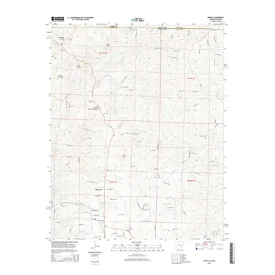
2014 Map of Midway
USGS Topo · Published 2014About this map
The Ozark plateau north of Midway is defined by the sharp transition between the upland ridges and the encroaching waters of Bull Shoals Lake. This survey illustrates the rural landscape along the state line between Arkansas and Missouri, where the community of Three Brothers serves as a local hub. The map provides significant genealogical value, documenting several family and community burial sites such as Oakland Cem, Three Brothers Cem, and Walker Cem. Higher elevations like Promise Land Ridge and Bald Dave overlook a network of winding creeks, including Little Pigeon Cr and Possum Walk Cr, that feed the larger reservoir system. The road network, including Ar-5 and Oakland RD, connects the scattered settlements of Arkawana and Midway through the deeply carved drainage basins of the White River watershed.
Find a feature on this map
108 named features on this map. Tap any name to fly to it.
Don’t see what you’re looking for? This feature index may not catch every label — zoom into the map to look around manually.
Map Details
Editions of this 2014 Midway Map
This is the sole edition of this map. No revisions or reprints were ever made.
Other maps of this area

1890 · Mountain Home
USGS Topo · 1:125,000

1891 · Mountain Home
USGS Topo · 1:125,000

1893 · Yellville
USGS Topo · 1:125,000

1894 · Mountain Home
USGS Topo · 1:125,000

1903 · Yellville
USGS Topo · 1:125,000

1905 · Yellville
USGS Topo · 1:125,000

1929 · Yellville
USGS Topo · 1:125,000

1934 · Gainesville
USGS Topo · 1:48,000

1936 · Thornfield
USGS Topo · 1:48,000

1940 · Gainesville
USGS Topo · 1:62,500