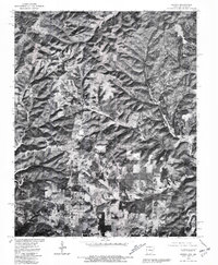
1979 Map of Midway
USGS Topo · Published 1981About this map
Midway and the surrounding Baxter County highlands are captured in this 1979 orthophotograph, which combines the precision of a topographic survey with the visual detail of aerial imagery. The landscape is defined by the winding ridges and deep drainages of the Ozark plateau, showing a clear pattern of hilltop settlement and valley floor agriculture. The community of Three Brothers sits at a high elevation, while the small cluster at Arkawana is situated between the local road network and the fingers of Bull Shoals Lake to the west. This specific edition is valuable for its documentation of land use and vegetation patterns during the late seventies, showing the extent of clearing for farms and homesites before modern development changed the rural character of this northern Arkansas border region.
Find a feature on this map
4 named features on this map. Tap any name to fly to it.
Don’t see what you’re looking for? This feature index may not catch every label — zoom into the map to look around manually.
Map Details
Editions of this 1979 Midway Map
This is the sole edition of this map. No revisions or reprints were ever made.
Other maps of this area

1890 · Mountain Home
USGS Topo · 1:125,000

1891 · Mountain Home
USGS Topo · 1:125,000

1893 · Yellville
USGS Topo · 1:125,000

1894 · Mountain Home
USGS Topo · 1:125,000

1903 · Yellville
USGS Topo · 1:125,000

1905 · Yellville
USGS Topo · 1:125,000

1929 · Yellville
USGS Topo · 1:125,000

1934 · Gainesville
USGS Topo · 1:48,000

1936 · Thornfield
USGS Topo · 1:48,000

1940 · Gainesville
USGS Topo · 1:62,500