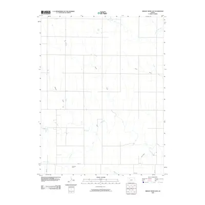
2009 Map of Midway Draw East
USGS Topo · Published 2009About this map
The Saline River and its tributary, the North Fork Saline River, define the hydrology of this High Plains landscape in central Gove County. The terrain is marked by a series of significant drainage features including Midway Draw, Leeds Draw, and Turner Draw, which illustrate the complex erosion patterns typical of the region's semi-arid geography. While much of the land remains open, human activity is anchored by aviation at Ashbaugh Airport and localized infrastructure along Gove EE. Further south, the meandering path of Gove Creek and the southern reach of the Saline River near Cow Draw provide a detailed look at the water-carved valleys that break the otherwise steady prairie topography. This survey captures a moment in the early 21st century when rural transportation was defined by established section lines and specialized airfield facilities.
Find a feature on this map
12 named features on this map. Tap any name to fly to it.
Don’t see what you’re looking for? This feature index may not catch every label — zoom into the map to look around manually.
Map Details
Editions of this 2009 Midway Draw East Map
This is the sole edition of this map. No revisions or reprints were ever made.
Other maps of this area

1954 · Goodland
USGS Topo · 1:250,000

1956 · Goodland
USGS Topo · 1:250,000

1957 · Goodland
USGS Topo · 1:250,000

1979 · Park
USGS Topo · 1:24,000

1979 · Midway Draw West
USGS Topo · 1:24,000

1979 · Midway Draw East
USGS Topo · 1:24,000
1979 · Grainfield
USGS Topo · 1:24,000

1979 · Hoxie
USGS Topo · 1:24,000

1979 · Tasco
USGS Topo · 1:24,000

1979 · Studley
USGS Topo · 1:24,000