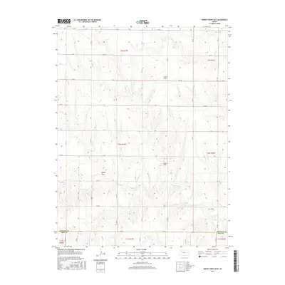
2015 Map of Midway Draw East
USGS Topo · Published 2015About this map
The Saline River and its major drainage features define this portion of the High Plains along the border of Sheridan Co and Gove Co. The landscape is characterized by a series of significant drainage systems, including N Fork Saline River, Gove Cr, and the extensive Midway Draw. This 2015 survey illustrates a land strictly divided by the Public Land Survey System, where a grid of rural roads such as RD 80 S and RD 40 E follows section lines across the breaks and draws. The map captures the specialized topography of Western Kansas, where named features like Turner Draw, Leeds Draw, and Cow Draw indicate the historical importance of water management and erosion patterns in this semi-arid agricultural region.
Find a feature on this map
31 named features on this map. Tap any name to fly to it.
Don’t see what you’re looking for? This feature index may not catch every label — zoom into the map to look around manually.
Map Details
Editions of this 2015 Midway Draw East Map
This is the sole edition of this map. No revisions or reprints were ever made.
Other maps of this area

1954 · Goodland
USGS Topo · 1:250,000

1956 · Goodland
USGS Topo · 1:250,000

1957 · Goodland
USGS Topo · 1:250,000

1979 · Park
USGS Topo · 1:24,000

1979 · Midway Draw West
USGS Topo · 1:24,000

1979 · Midway Draw East
USGS Topo · 1:24,000
1979 · Grainfield
USGS Topo · 1:24,000

1979 · Hoxie
USGS Topo · 1:24,000

1979 · Tasco
USGS Topo · 1:24,000

1979 · Studley
USGS Topo · 1:24,000