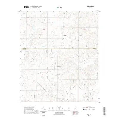
2018 Map of Midway
USGS Topo · Published 2018About this map
The boundary between Copiah and Lincoln Counties divides this section of southwest Mississippi, where small-scale rural settlements are interspersed among the headwaters of the S Fork Homochitto River and Bayou Pierre. The unincorporated community of Midway serves as a local focal point, surrounded by family and community landmarks such as Peets Cem and Sweetwater Cem. Further south, the settlement of Loyd Star appears near the banks of Jackson Cr. The map's detailed road network, including names like Jackson-Liberty Rd and Old Red Star Rd NW, reflects a long-standing pattern of agricultural and timber connectivity. Family history is well-represented through numerous burial grounds, including the Mercy Seat Cem near the upper edge and Macedonia Cem in the southeastern corner near the Macedonia community, providing essential geographic context for genealogical researchers studying this region.
Find a feature on this map
71 named features on this map. Tap any name to fly to it.
Don’t see what you’re looking for? This feature index may not catch every label — zoom into the map to look around manually.
Map Details
Editions of this 2018 Midway Map
This is the sole edition of this map. No revisions or reprints were ever made.
Other maps of this area

1953 · Natchez
USGS Topo · 1:250,000

1956 · Natchez
USGS Topo · 1:250,000

1959 · Natchez
USGS Topo · 1:250,000

1963 · Smyrna
USGS Topo · 1:24,000

1963 · Hazlehurst
USGS Topo · 1:24,000

1963 · Barlow
USGS Topo · 1:24,000

1972 · Midway
USGS Topo · 1:24,000

1972 · McCall Creek
USGS Topo · 1:24,000

1972 · Caseyville
USGS Topo · 1:24,000

1972 · Brookhaven
USGS Topo · 1:24,000