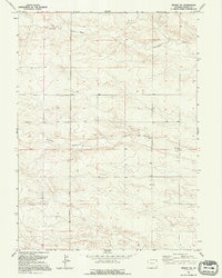
1991 Map of Midway SW
USGS Topo · Published 1995About this map
Hillsdale Road bisects this high plains landscape of Laramie County, tracing a north-south path through a region defined by its wide, seasonal drainage patterns. The terrain is characterized by the branching systems of Chivington Draw and Antelope Draw, which carve subtle relief into the prairie. While the map reflects the landscape as it appeared in the early 1990s, the underlying data originates from surveys as far back as 1958, revealing a remarkably stable rural environment. Aside from a small Gravel Pit near the southern edge, the map shows little industrial development, emphasizing the persistent agricultural and open-range character of this part of Wyoming. It is a portrait of a landscape where the primary human mark is the geometric grid of section lines and the occasional ranch road.
Find a feature on this map
6 named features on this map. Tap any name to fly to it.
Don’t see what you’re looking for? This feature index may not catch every label — zoom into the map to look around manually.
Map Details
Editions of this 1991 Midway SW Map
This is the sole edition of this map. No revisions or reprints were ever made.
Other maps of this area

1911 · Cheyenne
USGS Topo · 1:125,000

1914 · Cheyenne
USGS Topo · 1:125,000

1954 · Cheyenne
USGS Topo · 1:250,000

1958 · Cheyenne
USGS Topo · 1:250,000

1963 · Little Indian Draw
USGS Topo · 1:24,000

1963 · Burns
USGS Topo · 1:24,000

1963 · Pole Creek Ranch SE
USGS Topo · 1:24,000

1963 · Midway
USGS Topo · 1:24,000

1963 · Durham
USGS Topo · 1:24,000

1963 · Midway SE
USGS Topo · 1:24,000