
1963 Map of Durham
USGS Topo · Published 1967About this map
Union Pacific rails cut across this Laramie County landscape, anchoring the small siding of Durham. The topography is defined by the east-flowing drainages of Lodgepole Creek in the north and Crow Creek along the southern margin, creating a series of ridgelines and draws typical of the high plains. By the mid-1960s, the corridor was undergoing a significant transportation shift as the new Interstate 80 was established alongside the traditional route of U. S. 30. This transition illustrates the evolution from early transcontinental rail dominance to the modern interstate highway era. Infrastructure on the map is sparse but functional, featuring a major Pipeline and several scattered wells, reflecting the region's reliance on subterranean resources and long-distance transport networks.
Find a feature on this map
11 named features on this map. Tap any name to fly to it.
Don’t see what you’re looking for? This feature index may not catch every label — zoom into the map to look around manually.
Map Details
Editions of this 1963 Durham Map
2 editions found
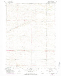
Other maps of this area

1911 · Cheyenne
USGS Topo · 1:125,000

1914 · Cheyenne
USGS Topo · 1:125,000

1954 · Cheyenne
USGS Topo · 1:250,000

1958 · Cheyenne
USGS Topo · 1:250,000

1963 · Arcola
USGS Topo · 1:24,000

1963 · Pole Creek Ranch SE
USGS Topo · 1:24,000

1963 · Midway SW
USGS Topo · 1:24,000
1963 · Pole Creek Ranch
USGS Topo · 1:24,000
1963 · Hillsdale
USGS Topo · 1:24,000
1963 · Campstool
USGS Topo · 1:24,000