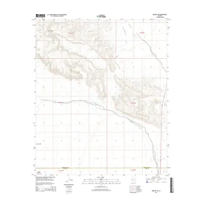
2014 Map of Midway SW
USGS Topo · Published 2014About this map
Crater Range dominate the northern landscape of this 2014 survey, where the arid terrain of Maricopa and Pima counties converges. The topography is defined by the steep elevation changes of these peaks, which give way to the broad alluvial plains of Childs Valley and the prominent rise of Childs Mountain to the south. This region is a study in desert hydrology, with the intricate drainage patterns of Midway Wash and the extensive network of Tenmile Wash carving paths across the basin floor. Transportation in this section of the Sonoran Desert is anchored by Az-85, which runs along the eastern edge of the quadrangle. The map captures the remote character of the borderlands between the two counties, documenting the complex system of sections and townships that organize this largely undeveloped wilderness.
Find a feature on this map
13 named features on this map. Tap any name to fly to it.
Don’t see what you’re looking for? This feature index may not catch every label — zoom into the map to look around manually.
Map Details
Editions of this 2014 Midway SW Map
This is the sole edition of this map. No revisions or reprints were ever made.
Other maps of this area

1932 · Ajo
USGS Topo · 1:62,500

1934 · Ajo
USGS Topo · 1:62,500

1953 · Ajo
USGS Topo · 1:250,000

1957 · Ajo
USGS Topo · 1:250,000

1958 · Ajo
USGS Topo · 1:250,000

1958 · Midway
USGS Topo · 1:62,500

1962 · Ajo
USGS Topo · 1:250,000

1963 · Ajo
USGS Topo · 1:250,000

1963 · Ajo
USGS Topo · 1:62,500

1964 · Growler Peak
USGS Topo · 1:62,500