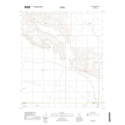
2018 Map of Midway SW
USGS Topo · Published 2018About this map
Crater Range dominates the northern landscape of this Pima and Maricopa County border region, characterized by its distinctive volcanic topography. To the south, the terrain opens into Childs Valley, a wide drainage basin defined by seasonal watercourses like Tenmile Wash and Midway Wash. The map illustrates the sparse, arid character of the Sonoran Desert in the late 2010s, where elevation shifts dramatically toward Childs Mtn at the southwestern edge. This area, largely defined by its natural landforms rather than human settlements, serves as a record of the survey lines and section boundaries that organize this remote stretch of southern Arizona.
Find a feature on this map
12 named features on this map. Tap any name to fly to it.
Don’t see what you’re looking for? This feature index may not catch every label — zoom into the map to look around manually.
Map Details
Editions of this 2018 Midway SW Map
This is the sole edition of this map. No revisions or reprints were ever made.
Other maps of this area

1932 · Ajo
USGS Topo · 1:62,500

1934 · Ajo
USGS Topo · 1:62,500

1953 · Ajo
USGS Topo · 1:250,000

1957 · Ajo
USGS Topo · 1:250,000

1958 · Ajo
USGS Topo · 1:250,000

1958 · Midway
USGS Topo · 1:62,500

1962 · Ajo
USGS Topo · 1:250,000

1963 · Ajo
USGS Topo · 1:250,000

1963 · Ajo
USGS Topo · 1:62,500

1964 · Growler Peak
USGS Topo · 1:62,500