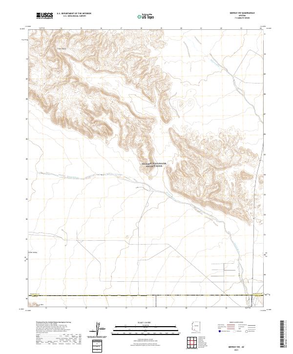
2021 Map of Midway SW
USGS Topo · Published 2021About this map
The Crater Range dominates the northern landscape of this Arizona quadrangle, characterized by its sharp topographic relief and volcanic origins within the Sonoran Desert. The map captures the boundary between Maricopa and Pima Counties as it crosses the arid expanse of Childs Valley. Ephemeral drainage patterns define the hydrology of the area, with Midway Wash and Tenmile Wash carving paths across the desert floor to the east and south. In the southwest corner, the elevation rises toward the prominent slopes of Childs Mtn, situated near the county line. The arrangement of these landforms and dry washes illustrates the geological transition from the basin floors to the desert mountains, offering a detailed perspective of this unpopulated stretch of the Arizona interior as it appeared in the early twenty-first century.
Find a feature on this map
12 named features on this map. Tap any name to fly to it.
Don’t see what you’re looking for? This feature index may not catch every label — zoom into the map to look around manually.
Map Details
Editions of this 2021 Midway SW Map
This is the sole edition of this map. No revisions or reprints were ever made.
Other maps of this area

1932 · Ajo
USGS Topo · 1:62,500

1934 · Ajo
USGS Topo · 1:62,500

1953 · Ajo
USGS Topo · 1:250,000

1957 · Ajo
USGS Topo · 1:250,000

1958 · Ajo
USGS Topo · 1:250,000

1958 · Midway
USGS Topo · 1:62,500

1962 · Ajo
USGS Topo · 1:250,000

1963 · Ajo
USGS Topo · 1:250,000

1963 · Ajo
USGS Topo · 1:62,500

1964 · Growler Peak
USGS Topo · 1:62,500