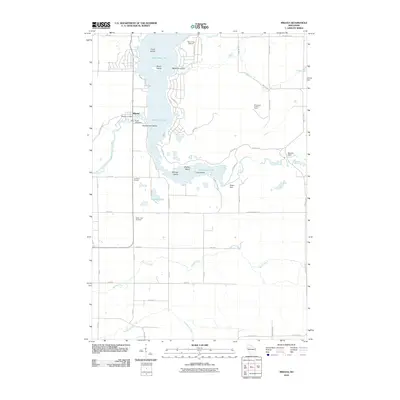
2010 Map of Mikana
USGS Topo · Published 2010About this map
Red Cedar Lake dominates this landscape, its waters broken by a series of named landforms including Faust Island, Stout Island, Honeymoon Island, and Bradys Island. The settlement of Mikana serves as a primary hub on the western shore, anchored by the Mikana Post Office and the Cedar Lake Dam at the head of the Red Cedar River. The shoreline reflects a transition toward recreational and residential use with numerous access roads like Lanark Dr and Easy Shore Rd winding through the timbered tracts and around the northern bays near McHenry Island.
Find a feature on this map
58 named features on this map. Tap any name to fly to it.
Don’t see what you’re looking for? This feature index may not catch every label — zoom into the map to look around manually.
Map Details
Editions of this 2010 Mikana Map
This is the sole edition of this map. No revisions or reprints were ever made.
Other maps of this area

1945 · Meteor
USGS Topo · 1:48,000

1948 · Weyerhauser
USGS Topo · 1:48,000

1949 · Meteor
USGS Topo · 1:48,000

1949 · Rice Lake
USGS Topo · 1:48,000

1950 · Weyerhauser
USGS Topo · 1:48,000

1951 · Rice Lake
USGS Topo · 1:48,000

1951 · Chetek
USGS Topo · 1:62,500

1953 · Rice Lake
USGS Topo · 1:250,000

1959 · Rice Lake
USGS Topo · 1:250,000

1965 · Rice Lake
USGS Topo · 1:62,500