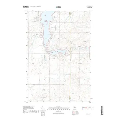
2018 Map of Mikana
USGS Topo · Published 2018About this map
Red Cedar Lake dominates this Barron County landscape, its irregular shoreline punctuated by several named landforms including Stout Island, Honeymoon Island, and McHenry Island. The settlement of Mikana sits along the western bank, serving as a focal point for the surrounding rural area. To the south, the terrain rises into the Blue Hills, while the Ice Age National Scenic Trail winds through the eastern portion of the quadrangle, crossing into Rusk County. A network of rural roads, such as Cheese Factory Rd and Freiss Ranch Rd, connects the scattered lakeside residences and inland farms. Local history is anchored at the Cedar Lake Cem, while the hydrological system is defined by the Red Cedar River and tributaries like Pokegama Cr and Hemlock Creek.
Find a feature on this map
47 named features on this map. Tap any name to fly to it.
Don’t see what you’re looking for? This feature index may not catch every label — zoom into the map to look around manually.
Map Details
Editions of this 2018 Mikana Map
This is the sole edition of this map. No revisions or reprints were ever made.
Other maps of this area

1945 · Meteor
USGS Topo · 1:48,000

1948 · Weyerhauser
USGS Topo · 1:48,000

1949 · Meteor
USGS Topo · 1:48,000

1949 · Rice Lake
USGS Topo · 1:48,000

1950 · Weyerhauser
USGS Topo · 1:48,000

1951 · Rice Lake
USGS Topo · 1:48,000

1951 · Chetek
USGS Topo · 1:62,500

1953 · Rice Lake
USGS Topo · 1:250,000

1959 · Rice Lake
USGS Topo · 1:250,000

1965 · Rice Lake
USGS Topo · 1:62,500