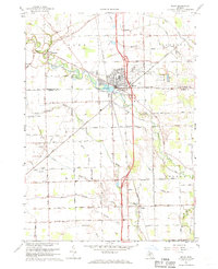
1967 Map of Milan
USGS Topo · Published 1970About this map
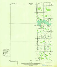
The Saline River winds through the heart of this southeast Michigan landscape, defining the character of Milan and the outlying hamlet of Mooreville. In the late 1960s, the region was characterized by its intricate network of drainage systems, including Bear Swamp and McIntyre Drain, which supported a productive agricultural economy. The Norfolk and Western railroad and the Federal Correctional Institution represent the town's industrial and institutional footprints during this period. Local history is deeply etched into the terrain through features like the Old Indian Treaty Boundary and several rural burying grounds such as Marble Park Cemetery and Rice Cem. Further south, the map details the small settlement of Azalia near the confluence of Macon Creek, showcasing the transition from township centers to the surrounding open fields of York and London townships.
Find a feature on this map
56 named features on this map. Tap any name to fly to it.
Don’t see what you’re looking for? This feature index may not catch every label — zoom into the map to look around manually.
Map Details
Editions of this 1967 Milan Map
2 editions found
Other maps of this area

1902 · Ypsilanti
USGS Topo · 1:62,500

1904 · Ann Arbor
USGS Topo · 1:125,000

1906 · Ypsilanti
USGS Topo · 1:62,500

1906 · Saline
USGS Topo · 1:62,500

1908 · Ann Arbor
USGS Topo · 1:125,000

1912 · Dundee
USGS Topo · 1:62,500

1926 · Dundee
USGS Topo · 1:62,500
1936 · Maybee
USGS Topo · 1:31,680
1936 · Ida
USGS Topo · 1:31,680
1936 · Ypsilanti East
USGS Topo · 1:31,680