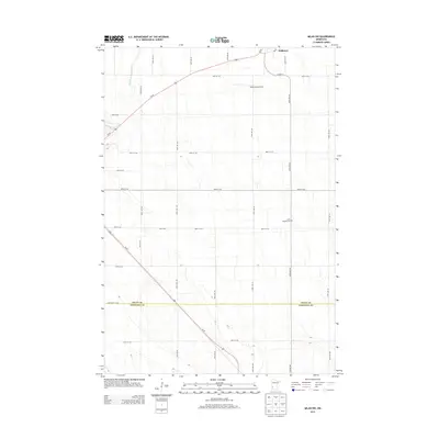
2013 Map of Milan NW
USGS Topo · Published 2013About this map
Holloway sits in the northeast corner of this agricultural region, serving as a hub where the Po and CO Hwy-9 converge. The landscape is defined by the sweeping course of Us-59, which cuts diagonally across the prairie from the northwest toward the southeast, connecting the scattered farmsteads of the Minnesota plains. The Pomme de Terre River meanders through the northwest, providing a rare natural break in the structured grid of section lines and gravel roads such as 60th St SW and 200th Ave SW. This 2013 survey illustrates the modern rural infrastructure, including the private Home-Base Airport and the lonely location of Saint Josephs Cem miles from the nearest town center. The boundary between Swift Co and Chippewa Co is clearly demarcated, showing how political lines bisect this productive farmland.
Find a feature on this map
29 named features on this map. Tap any name to fly to it.
Don’t see what you’re looking for? This feature index may not catch every label — zoom into the map to look around manually.
Map Details
Editions of this 2013 Milan NW Map
This is the sole edition of this map. No revisions or reprints were ever made.
Other maps of this area

1953 · Milbank
USGS Topo · 1:250,000

1953 · Saint Cloud
USGS Topo · 1:250,000

1957 · Saint Cloud
USGS Topo · 1:250,000

1958 · Milbank
USGS Topo · 1:250,000

1958 · Saint Cloud
USGS Topo · 1:250,000

1958 · Cerro Gordo
USGS Topo · 1:24,000

1958 · Milan
USGS Topo · 1:24,000

1958 · Big Bend City
USGS Topo · 1:24,000

1958 · Watson
USGS Topo · 1:24,000

1958 · Milan NW
USGS Topo · 1:24,000