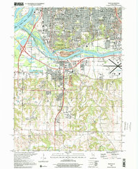
2000 Map of Milan
USGS Topo · Published 2001About this map
The confluence of the Mississippi River and the Rock River anchors this detailed study of the Quad Cities area at the close of the millennium. The landscape is a complex intersection of heavy industry, transportation hubs, and historic preserved lands. The Hennepin Canal cuts through the river valley, while the northern extent shows the dense urban grid of Rock Island, Moline, and South Moline. Genealogists will find a wealth of data in the many cemeteries, including the large Chippiannock Cem and Calvary Cem, as well as numerous neighborhood schools such as Audubon Sch and John Deere Jr High Sch.
Find a feature on this map
75 named features on this map. Tap any name to fly to it.
Don’t see what you’re looking for? This feature index may not catch every label — zoom into the map to look around manually.
Map Details
Editions of this 2000 Milan Map
This is the sole edition of this map. No revisions or reprints were ever made.
Other maps of this area

1891 · Davenport
USGS Topo · 1:62,500

1892 · Leclaire
USGS Topo · 1:62,500

1893 · Leclaire
USGS Topo · 1:62,500

1894 · Davenport
USGS Topo · 1:62,500

1899 · Clinton
USGS Topo · 1:125,000

1901 · Rock Island
USGS Topo · 1:125,000

1910 · Rock Island
USGS Topo · 1:125,000

1912 · Milan
USGS Topo · 1:62,500

1937 · Orion
USGS Topo · 1:62,500

1944 · Milan
USGS Topo · 1:62,500