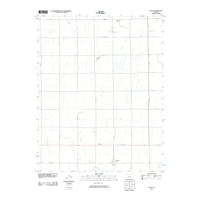
2010 Map of Milan
USGS Topo · Published 2010About this map
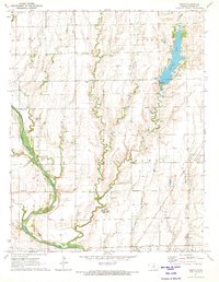
The Chikaskia River winds through the southern portion of this Sumner County landscape, anchoring a rural territory defined by its organized grid of farm-to-market roads and several persistent creek systems. The town of Milan sits near the southern border, while the small settlement of Ewell is positioned further north along N Bluff Rd. This 2010 survey documents the enduring agricultural patterns of the region, where legacy landmarks like the Amish Cemetery and Spring Hill Cemetery remain preserved at the northern edge. Significant drainage is provided by Shore Creek and Silver Creek, which bisect the township sections. The map provides a clear look at the intersection of local routes like W 10th Ave and N Milan Rd, essential for understanding the modern movement of people and goods through these plains.
Find a feature on this map
26 named features on this map. Tap any name to fly to it.
Don’t see what you’re looking for? This feature index may not catch every label — zoom into the map to look around manually.
Map Details
Editions of this 2010 Milan Map
This is the sole edition of this map. No revisions or reprints were ever made.
Other maps of this area

1889 · Caldwell
USGS Topo · 1:125,000

1893 · Caldwell
USGS Topo · 1:125,000

1897 · Caldwell
USGS Topo · 1:125,000

1955 · Wichita
USGS Topo · 1:250,000

1958 · Wichita
USGS Topo · 1:250,000
1971 · Norwich
USGS Topo · 1:24,000

1971 · Caldwell NW
USGS Topo · 1:24,000
1971 · Argonia
USGS Topo · 1:24,000
1971 · Millerton
USGS Topo · 1:24,000
1971 · Perth
USGS Topo · 1:24,000