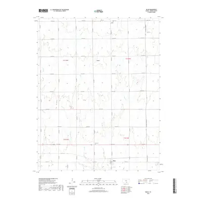
2018 Map of Milan
USGS Topo · Published 2018About this map
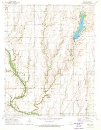
Milan serves as the primary hub of this Sumner County landscape, anchored at the junction of W 10th Ave and S Madison St. The surrounding countryside is defined by a grid of agricultural roads and several significant drainage systems, including Silver Cr and Shore Cr, which wind through the township boundaries of T31S and T32S. Small pockets of local history are preserved in the rural cemeteries that dot the map, such as the Amish Cem and Spring Hill Cem located in the northern reaches, and the Milan Cem just north of the town site.
Find a feature on this map
40 named features on this map. Tap any name to fly to it.
Don’t see what you’re looking for? This feature index may not catch every label — zoom into the map to look around manually.
Map Details
Editions of this 2018 Milan Map
This is the sole edition of this map. No revisions or reprints were ever made.
Other maps of this area

1889 · Caldwell
USGS Topo · 1:125,000

1893 · Caldwell
USGS Topo · 1:125,000

1897 · Caldwell
USGS Topo · 1:125,000

1955 · Wichita
USGS Topo · 1:250,000

1958 · Wichita
USGS Topo · 1:250,000
1971 · Norwich
USGS Topo · 1:24,000

1971 · Caldwell NW
USGS Topo · 1:24,000
1971 · Argonia
USGS Topo · 1:24,000
1971 · Millerton
USGS Topo · 1:24,000
1971 · Perth
USGS Topo · 1:24,000